

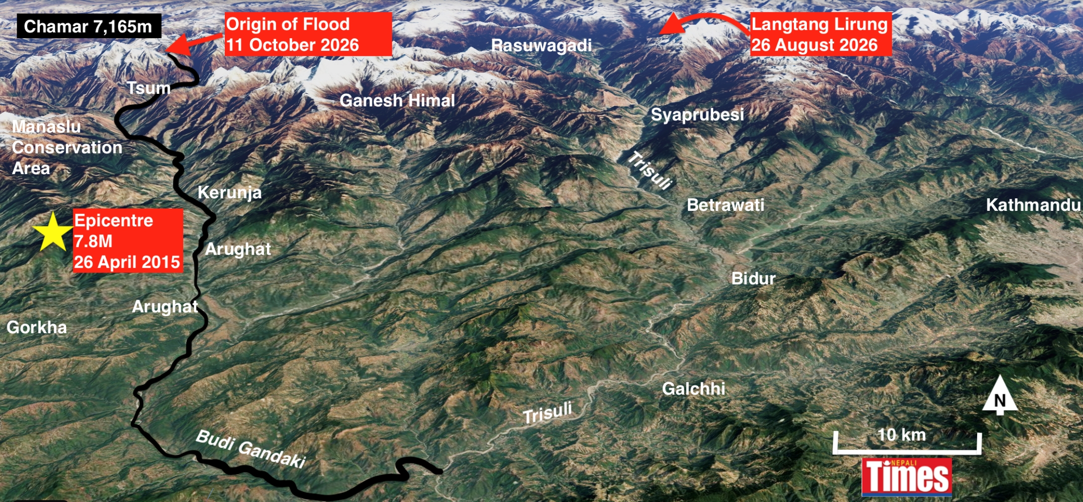
Even as Nepal tries to cope with the enormous flood catastrophe on the Trisuli Valley six weeks ago, another massive debris flow devastated the adjacent Budi Gandaki Valley in the early hours of 11 October.
Phone alerts from the residents of Tsum Valley upstream, from the government’s disaster prevention agency, as well as the fact that the river ominously stopped flowing, gave people down the valley enough time to heed the warning and climb slopes for safety just before dawn on Sunday. The memory of the recent Trisuli flood appears to have convinced many not to take the alerts lightly.
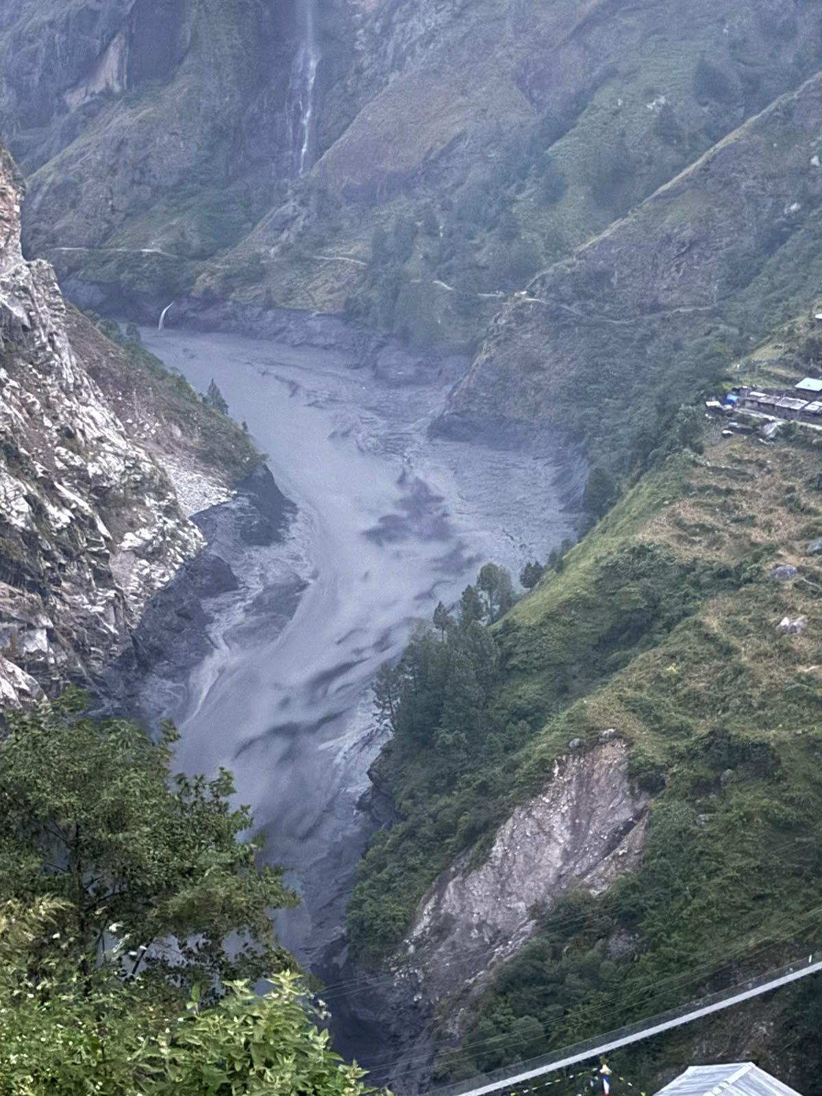
About 10 yak and sheep herders in Tsum Valley directly below the mountain are said to be missing, while further downstream, highway and trail bridges as well sections of the Manaslu circuit were swept away. All Nepali and foreign trekking teams and their guides on the trail are said to be safe because of the timely warning.
The Trisuli disaster itself happened exactly a year after a deadly glacial flood on the same river, and following similar debris flows on the Melamchi and other rivers in recent years. Experts warn that climate breakdown and geological factors may trigger more frequent disasters across the Himalaya in future.
“Coming so soon after the Guirong-Rasuwa disaster of 26 August, Sunday’s event is another reminder of how exposed mountain communities and river corridors remain to sudden, cascading disasters,” said Pema Gyamtsho, Director General of the Kathmandu-based International Centre for Integrated Mountain Development (ICIMOD).
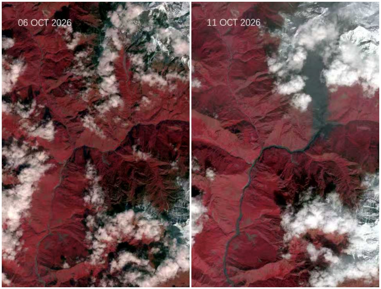
Photo credit: Nepali Times
Sunday morning’s flood was puzzling because there had been no heavy precipitation in the Budi Gandaki catchment area over the weekend, even though Central Nepal saw massive blizzards and rainfall earlier this month that deposited more than 3m of snow. Mountaineering expeditions on nearby Mt Manaslu (8,091m) were abandoned because of avalanche danger and after four climbers were killed.
The 11 October flood appears to have been triggered by heavy snow deposition, global warming, and the long-term effect of the 7.8M earthquake in 2015 which was epicentered only 10km to the southwest. This probably led a rock face or glacier, or both, on the east face of Mt Chamar (7,165m) to collapse.






Comments
0 commentsNo comments yet — be the first.